Course Map - Copenhagen Marathon
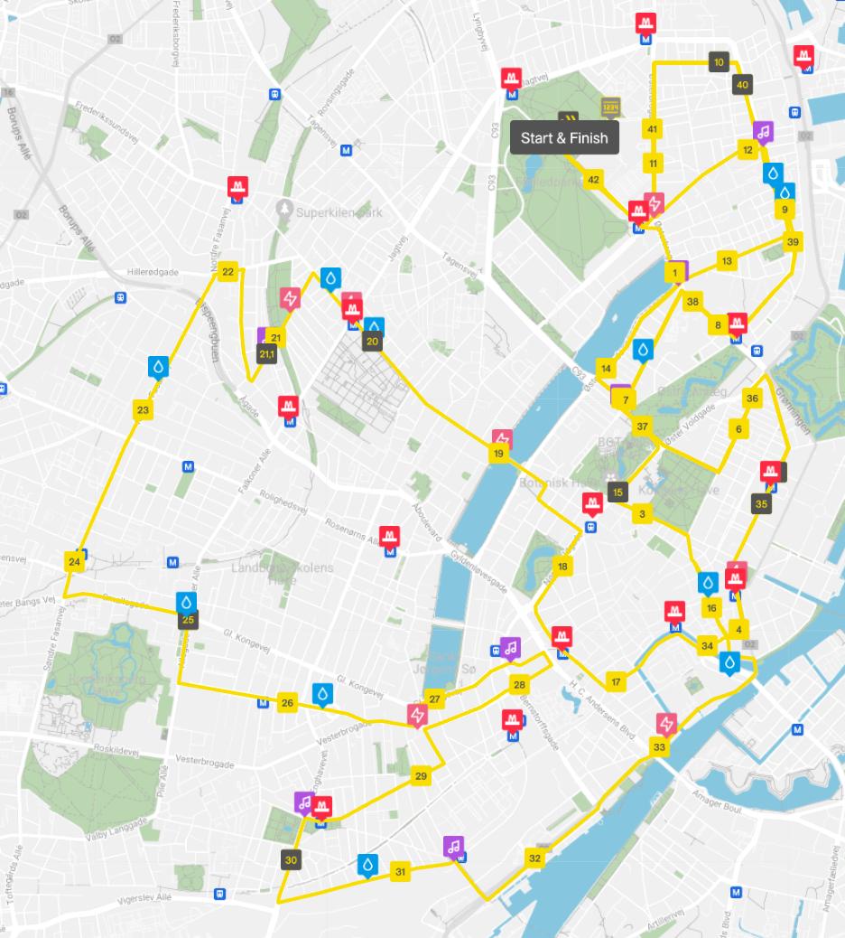
The Copenhagen Marathon course is known for being very flat, fast, and scenic, making it one of Europe’s top races for personal bests. The route takes runners through the heart of Copenhagen and showcases many of the city’s most famous neighborhoods, canals, bridges, and landmarks.
The marathon starts and finishes on Øster Allé near Fælledparken, creating a stadium-like atmosphere with huge crowds and live entertainment. Early in the race, runners head toward the harbor area and cross several iconic bridges with panoramic water views.
Around 10 km, the course passes through the historic canals of Christianshavn and Amager, where runners cross Knippelsbro and Langebro bridges overlooking Copenhagen Harbour. The route then moves through the lively multicultural district of Nørrebro and across Queen Louise’s Bridge, one of the loudest spectator zones on the course.
The middle part of the race includes the elegant tree-lined Frederiksberg Allé and the vibrant streets of Vesterbro, including Istedgade near Tivoli Gardens. Later, runners pass modern architectural highlights such as the Kaktus Towers and BLOX building before entering the historic city center.
The final 10 kilometers are especially memorable. The course winds past famous landmarks including Nyhavn, Kongens Nytorv, the Royal Danish Theatre, Amalienborg Palace, and the Marble Church before heading through the historic yellow houses of Nyboder.
From there, runners return toward Østerbro for a dramatic finish on Øster Allé, where thousands of spectators line the barriers creating one final surge of energy to the finish line.
The entire course has only about 85 meters of elevation gain, making it exceptionally fast and ideal for elite racing and first-time marathoners alike