Course Map: Warsaw Marathon 2025
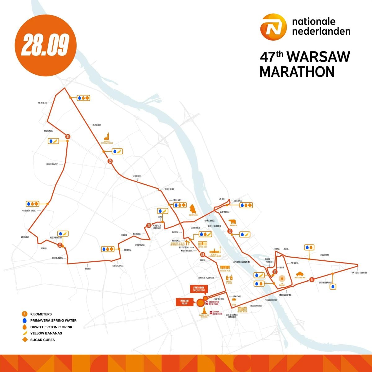
The 2025 Warsaw Marathon course is designed as a single loop (42.195 km) that highlights both historic and modern parts of the city while keeping the route relatively flat and fast.
Start and Finish
Start: Świętokrzyska Street, by the Palace of Culture and Science (central Warsaw).
Finish: Same area, creating a city-center hub with easy access for runners and spectators.
Route Overview
The course takes runners along Warsaw’s Royal Route, passing through Nowy Świat and Krakowskie Przedmieście, two of the most iconic streets lined with historic buildings, cafés, and cultural landmarks.
Runners then cross the Poniatowski Bridge, which offers views of the Vistula River and the National Stadium (PGE Narodowy).
The route winds through several districts, combining modern urban scenery with green stretches, giving athletes a varied but smooth-running experience.
Landmarks include:
- The Old Town area with its UNESCO World Heritage charm
- Wide city boulevards ideal for maintaining rhythm
- A mix of riverside sections and leafy avenues
Course Profile
Elevation: Approx. 93 meters total gain, ranging between 80–113.4 m above sea level.
The course is regarded as fast by marathon standards: mostly flat, with gentle inclines and declines spread across the city.
Support Along the Way
- Water stations every 2.5 km (from 5 km)
- Isotonic drinks and bananas from 10 km, every second station
- Toilets available near aid stations
- Medical points strategically placed
- This layout makes Warsaw appealing both for elite athletes chasing fast times and for first-time marathoners looking for an accessible, well-organized course.